


What turns a wave measurement into a prediction your crew can trust?
Picture a vessel holding position offshore. The next operation has been carefully planned, the crew is briefed, and the weather forecast suggests conditions are within operational limits.
But then the vessel starts moving more than expected. The sea looks much the same as it did earlier.
Is this a temporary variation or a sign of changing sea conditions? Will it now impact the lifting operation, personnel transfer or equipment deployment about to begin? How can the crew make an informed decision about whether to proceed?
Local, real-time sea state measurements can help. By providing an accurate picture of the sea conditions around the vessel, they help bridge the gap between forecasts and what is happening offshore.
But having access to data is only the first step. The real value comes from understanding the measurements, connecting them to operational decisions and building more advanced capabilities as needs evolve.
Start with the operational question: Do you understand the wave conditions around your vessel during operations?
Begin with a task the crew recognizes. For a Chief Officer preparing a deck cargo transfer on a platform supply vessel, that might mean understanding the wave conditions along the vessel during the operation. Identify the question and the people who need the answer.
One of our offshore vessel customers began with just such a need. They already had forecasts and experienced personnel, but wanted a continuous, measured real-time reference for the local sea state. The first installation used a single non-contact wave sensor, with significant wave height and wave period as the initial parameters.
Forecasts remain part of planning. Real-time measurements add information about conditions at the measurement location.
Before you add more data, decide what the first measurement is for. Name the decision it should inform. For the Chief Officer, that could be the call on whether to start the deck cargo transfer.
Then set a first goal the team can check.
Can the crew find the measurement when they need it? Can they explain what significant wave height and wave period mean for this vessel and this task? Are they using it in the go/no-go discussions you identified? Once the answer to each is yes, crew and management share a clear baseline.
Know what the number represents: Is the sensor wrong, or are you comparing two different things?
Say a larger wave passes the vessel while the significant wave height changes little. Significant wave height, commonly written Hs, is a statistical measure approximately corresponding to the average height of the highest third of waves. Individual waves can be higher. Wave period is the time between successive wave crests passing a fixed point. Displays can present it in more than one way, so confirm which period parameter yours shows.
The measurement context is equally important. Identify the sensor location, the area or point it observes, the reporting interval and the quality information available. Understand how the system accounts for vessel motion. A downward-looking range measurement from a moving platform needs appropriate motion compensation to distinguish surface movement from sensor movement.
A reading from one point on the vessel does not describe every point around the hull. Check the timestamp and the averaging period used for statistical parameters. Those details help distinguish a live display update from the passage of an individual wave.
Ask the watch team to explain the parameter in relation to the task.
Build confidence through operational use: When the sea changes, what changes on the display?
Give the team opportunities to compare measurements with conditions and vessel behavior during normal work. When a measurement seems surprising, review the observation, the parameter definition and the data quality together.
In our customer’s initial experience, personnel compared wave readings with what they could see and feel. Over time, they began relating combinations of wave height and period to their vessel’s behavior.
A Master and Chief Officer can bring that same learning into a briefing: the measured conditions, the planned task and the relevant operating limits. Recording the conditions and the vessel’s operating state gives later reviews something specific to examine.
Visual agreement helps build familiarity, but technical verification is still necessary to confirm measurement performance. Confidence requires both reliable measurements and an understanding of their operational significance.
Progress shows when people can explain what the readings mean for their work, identify gaps and raise questions that experience alone or the initial parameters do not fully answer.
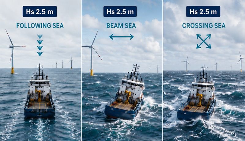
Add context when the question changes: Why can a familiar significant wave height accompany a different vessel response?
Wave period and direction relative to heading can help explain the difference. Waves approaching the bow, beam or stern do not produce the same response in every case.
Add directional information when it addresses a specific operational need. Surface current measurement can provide further context for a Dynamic Positioning Officer considering environmental conditions on a construction support vessel. It does not provide a current profile through the water column.
This expansion requires the right measurement configuration. Combining X-band radar with a downward-looking wave sensor adds directional wave and surface-current information to the local wave measurements.
Before interpreting directional data, confirm the reference frame and conventions in the system documentation. Wave direction must be understood in relation to the vessel’s heading and the operation.
The key question: Can users understand and explain the purpose of each additional measurement? Confirm the required equipment, interfaces and data quality before introducing new parameters.
Video clip: 3D vessel view
3D interface in Miros WaveSystem, showing where each wave measurement is taken. It brings each installed measurement source, its measurement area and the key wave values together in one intuitive display, providing a bird’s-eye view of the sea state data most relevant to safeguard operations.
Source: Miros WaveSystem 3D vessel visualization
Connect the waves with the vessel: Which approaching waves and associated motions would be useful to anticipate?
Now bring measured vessel response into the discussion. Vessel design, size, loading condition, heading and operating mode all influence how a vessel responds to the sea. Wave height alone cannot describe the implications for every operation.
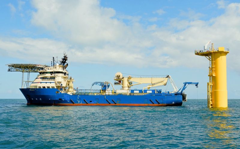
For a service operation vessel preparing a gangway connection, relate the environmental conditions to vessel motions and the applicable equipment and operational limits. For a research or survey vessel recovering an instrument, connect the wave conditions with the motions affecting equipment handling.
Assess these relationships in the context of the specific vessel and operation. Keep wave measurements, vessel motions and equipment performance distinct. Understanding one does not automatically establish the others.
Identify the motion, such as heave, roll or pitch, and where on the vessel it matters.
Evaluate the prediction against actual outcomes: How do you know the prediction is right?
Approach prediction with the same discipline as the initial measurements. Establish what is being predicted, how far ahead, under which conditions and with what level of uncertainty.
Miros’ PredictifAI technology, for example, combines X-band radar observations of incoming waves, local downward-looking wave measurements and artificial intelligence. It provides deterministic predictions of waves and vessel motion, including when they will occur. The published prediction horizon ranges from seconds to a couple of minutes, depending on installation and operating conditions.
Available predicted output depends on the installation. Motions influenced by dynamic positioning, navigation or crane operations cannot automatically be predicted from wave measurements alone.
Compare predictions with subsequent measurements to assess their accuracy. Consider the timing and size of the event, the uncertainty involved and the conditions in which the comparison was made. Review the results with relevant personnel before deciding how predictions should support operations.
The available prediction might support a critical phase of a lifting operation or a remotely operated vehicle (ROV) deployment. But the prediction horizon alone cannot establish suitability for an entire operation extending beyond it.
Understanding the measurements helps users look beyond the “black box.” Confidence starts with reliable input data, but predictions must also demonstrate their accuracy and operational value.
Video clip: PredictifAi traffic light display
Miros’ PredictifAI technology combines X-band radar observations of incoming waves, local downward-looking wave measurements and artificial intelligence. It provides deterministic wave and vessel motion prediction, from seconds to a couple of minutes, depending on installation and operating conditions.
Source: Miros PredictifAI traffic light display
Make the information part of the watch
The next watch should also be able to use and question the information. Integrate it into training, handovers, toolbox talks and operational reviews, ensuring its role within existing procedures is clear. Establish how personnel should respond when data is unavailable or unreliable.
A Marine Operations Manager with access to the same measurements can discuss plans with the offshore team using a shared understanding of conditions. A Marine Superintendent can help integrate the technology into training and procedures, in line with the operator’s defined responsibilities.
A Coast Guard vessel preparing to launch or recover a small boat must also consider local sea conditions and vessel motions in the context of the task.
Prediction remains one input alongside forecasts, procedures, measured conditions and established operational limits. Qualified personnel retain responsibility for operational decisions.
Back on board, the next operation still requires a decision. Better-informed discussions can start with a single trusted measurement, then build toward directional waves, surface currents, vessel response and prediction.
Measure. Understand. Trust. Expand. Predict.
One trusted measurement. One practical step at a time.
Some organizations may benefit from a more comprehensive system from the outset. For those new to wave monitoring, the priority is to establish the value of the initial measurements before expanding.
Which operational question could your team answer more confidently with access to accurate, local, real-time sea state measurements?
Note: The opinions, beliefs, and viewpoints expressed in this article do not necessarily reflect the opinions of offshore-energy.biz.